How Gamma-Based Soil Scanning Works in Modern Agriculture
Understanding the sensing physics, calibration discipline, and agronomic interpretation that make gamma-based soil scanning valuable at field scale.
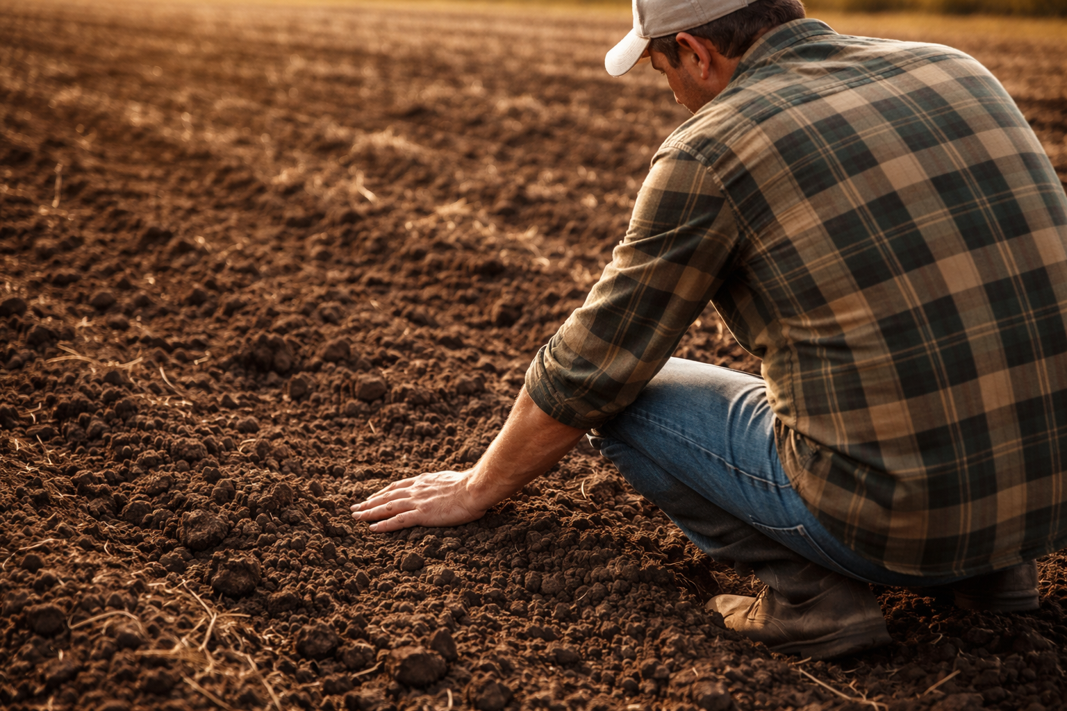
Modern precision agriculture increasingly depends on spatial accuracy.
Yet many soil decisions are still built on sparse point sampling.
Gamma-based soil scanning introduces a different methodology: continuous, physics-based sensing calibrated to laboratory reference data and interpreted through agronomic modeling.
This is not simply a new way to collect more data.
It is a more rigorous way to understand field-scale variability.
This article explains how the technology works, where its strengths lie, and why it matters operationally.
1. The Physical Principle: Natural Gamma Emissions
All soils contain naturally occurring radioactive isotopes, primarily:
- Potassium-40 (⁴⁰K)
- Uranium-series elements
- Thorium-series elements
These isotopes emit low-level gamma radiation continuously. The intensity and spectral distribution of this radiation are influenced by the mineral composition of the soil and often correlate strongly with:
- Mineral composition
- Clay content
- Soil texture
- Presence of potassium-bearing minerals
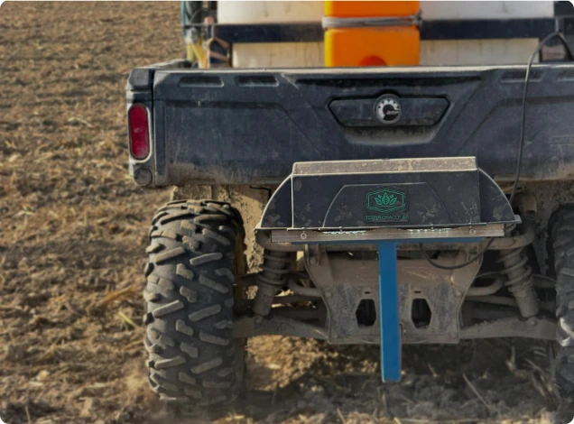
Gamma spectrometry sensors measure these emissions in real time as equipment moves across the field.
Importantly, this is passive sensing - nothing is emitted into the soil. The system simply detects naturally occurring radiation signatures.
2. From Radiation to Soil Properties
Raw gamma counts alone are not agronomic insight.
The process typically involves:
Step 1 - Continuous Field Measurement
Sensors mounted on a tractor or ATV collect gamma spectra across the entire field.
Step 2 - Spectral Analysis
The measured spectrum is decomposed into isotope-specific components (K, U, Th channels).
Step 3 - Correlation With Soil Characteristics
Statistical and machine-learning models relate spectral signatures to soil properties such as:
- Clay percentage
- Texture classification
- Cation exchange capacity
- Exchangeable potassium (with calibration)
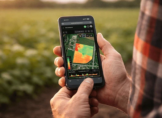
At this stage, the system produces high-resolution spatial layers that describe structure and variability.
But calibration is critical.
3. The Role of Laboratory Calibration
Gamma-based scanning becomes agronomically meaningful only when calibrated against physical soil samples.
Typical workflow:
- Identify representative zones from gamma maps
- Collect soil samples within those zones
- Send samples for laboratory analysis
- Train predictive models linking gamma signatures to lab-measured nutrients
This step transforms a sensing signal into an agronomically usable model.
Without calibration, maps primarily reflect mineral variation and spatial structure.
With calibration, they can support interpretation of nutrient behavior, constraint patterns, and agronomic potential.
4. Why Resolution Changes Decision Quality
Traditional 2-hectare grid sampling may provide 30 data points in a medium-sized field.
Gamma scanning produces thousands of measurement points per hectare.
This resolution allows:
- Clear zone delineation
- Identification of abrupt soil transitions
- Detection of sub-hectare constraints
- Improved interpolation accuracy
Higher resolution does not simply increase data volume - it improves zone delineation and reduces uncertainty in decision-making.
5. Field Case: Identifying Hidden Texture Transitions
A 240-hectare maize operation in Eastern Europe had persistent yield inconsistencies despite stable fertilizer programs.
Grid sampling showed moderate potassium levels and acceptable pH.
Continuous gamma scanning revealed:
- A previously undetected clay ridge crossing the field
- Light-textured sandy zones with rapid nutrient leaching
- Strong spatial differences in cation exchange capacity
After calibration and zone delineation:
- Potassium rates were reduced in clay-heavy areas
- Split nitrogen applications were increased in lighter soils
- Irrigation scheduling was adjusted based on retention capacity
Result over two seasons:
- 8% nitrogen reduction
- Improved yield uniformity
- Reduced variability in grain moisture at harvest
The issue was not nutrient absence - it was unrecognized spatial heterogeneity.
6. Field Case: Potassium Over-Application in Mineral-Rich Zones
In a high-input wheat farm managing over 600 hectares, fertilizer recommendations were based on averaged lab values.
Gamma scanning identified zones naturally rich in potassium-bearing minerals.
After zone-based recalibration:
- Potassium application reduced by 15% in mineral-rich zones
- Resources reallocated to lower-reserve areas
- Overall K input reduced without yield decline
The financial impact exceeded the scanning cost in a single season.
7. Limitations and Responsible Use
Gamma-based scanning does not directly measure:
- Nitrate levels
- Short-term nutrient fluctuations
- Biological activity
It measures mineral composition and related field structure.
Its performance and interpretation also depend on disciplined implementation. Signal quality and agronomic usefulness can be influenced by calibration quality, local field conditions, moisture dynamics, and how well sensing outputs are integrated with laboratory and agronomic context.
Therefore, best practice includes:
- Periodic recalibration
- Integration with crop data
- Consideration of agronomic context
- Careful interpretation within local field conditions
Technology provides structure. Agronomy provides interpretation.
8. From Measurement to Decision Infrastructure
Gamma-based soil scanning is not merely a mapping tool.
When combined with calibrated models and AI-based agronomic interpretation, it becomes a decision infrastructure layer.
The structural advantages include:
- Field-scale spatial continuity
- Reduced interpolation error
- Improved variable-rate prescription accuracy
- More economically disciplined decisions based on real variability
As machinery increasingly supports variable-rate input application, the limiting factor shifts from application capability to data quality, calibration discipline, and spatial resolution.
Continuous gamma-based soil intelligence addresses that limitation directly.
Closing Perspective
Soil variability has always existed.
What has changed is our ability to measure it at operational scale.
Gamma-based scanning, when properly calibrated and integrated into agronomic workflows, enables:
- More precise fertilizer allocation
- Improved margin management
- Reduced input waste
- Better risk control under volatile pricing
In modern agriculture, the competitive advantage lies not in applying more inputs - but in applying the right input, in the right zone, at the right rate.
And that begins with measurement quality and resolution.