From Scan to Prescription: How Variable Rate Maps Are Generated
How high-resolution soil scanning, agronomic validation, and the Terra Oracle AI Portal transform raw spatial data into actionable VRA maps and prescription outputs.

Modern farms are no longer limited by machinery capability.
Many large-scale operations today already have:
- Variable-rate spreaders
- Section control sprayers
- Precision planters
- Connected machinery platforms
The constraint is no longer application technology.
The constraint is decision quality.
Generating a variable-rate (VRA) map is not simply a matter of drawing zones. It is a structured workflow that transforms high-resolution soil data into field-ready, economically informed actions.
This article explains how that transformation occurs - and why it makes a measurable difference in the field.
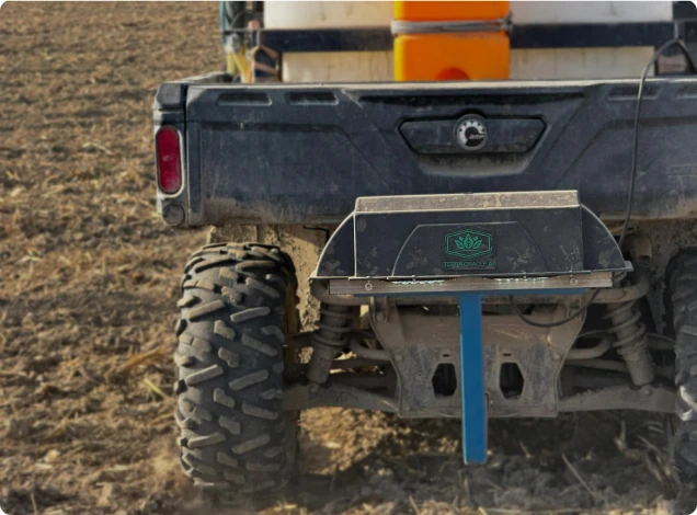
Step 1: Continuous Soil Scanning - Building the Spatial Foundation
The process begins with high-resolution soil sensing.
Gamma-based scanning collects continuous measurements across the field, capturing variability in:
- Mineral composition
- Texture
- Clay content
- Potassium-bearing minerals
Unlike grid sampling, which interpolates between sparse points, continuous scanning builds a spatially coherent dataset.
However, spatial resolution alone is insufficient. The data must be calibrated.
Step 2: Calibration and Model Training - Converting Signal Into Agronomy
Representative soil samples are collected from distinct zones identified in the scan.
Laboratory analysis provides validated measurements of:
- pH
- Exchangeable nutrients
- Organic matter
- Cation exchange capacity
These results are used to train predictive models linking sensor signatures to agronomic parameters - following established digital soil mapping frameworks (McBratney et al., 2003; Minasny & McBratney, 2016).
Modern systems increasingly incorporate machine learning techniques, including regression models and ensemble approaches, to improve predictive robustness (Viscarra Rossel et al., 2010).
The result is not a visual heatmap - it is a spatially validated nutrient layer.
Step 3: Zone Delineation - Structuring Variability
Once calibrated soil layers are generated, the next task is to structure variability into zones that are agronomically meaningful and operationally practical.
In the Terra Oracle AI Portal, VRA planning begins by selecting the source context for zoning, such as:
- Soil
- NDVI
From there, the user can choose among the current zoning methods available in the Portal:
- Lab
- Equal Interval
- Equal Area
- Standard Deviation
- Manual
The purpose is not to make zoning look mathematically sophisticated. The purpose is to organize variability in a way that supports better decisions and practical execution.
Research in precision agriculture demonstrates that structured zone delineation improves nutrient allocation efficiency compared to uniform or coarse grid strategies (Taylor et al., 2007; Mulla, 2013).
At this stage, variability is no longer abstract. It becomes structured.
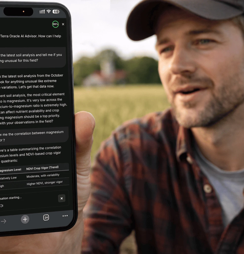
Step 4: Agronomic Logic + AI - From Nutrient Status to Decision
This is where transformation occurs.
A soil map shows nutrient distribution.
A prescription map determines what to apply.
The Terra Oracle AI platform integrates:
- Soil nutrient layers
- Crop type
- Yield targets
- Historical management
- Fertilizer prices
- Weather patterns
- Economic constraints
The Terra Oracle AI Advisor helps evaluate:
- Nutrient sufficiency levels
- Response probability curves
- Diminishing return thresholds
- Margin optimization scenarios
Instead of maximizing yield blindly, the system can help simulate economic outcomes - aligning fertilizer rates with profitability rather than theoretical maximum production.
This aligns with agronomic research emphasizing site-specific nutrient management and economic optimization in precision farming systems (Zhang et al., 2002; Gebbers & Adamchuk, 2010).
The key shift is this:
Data describes variability.
AI interprets variability.
Prescriptions operationalize variability.
Step 5: VRA Map Tuning and Prescription Generation
Once the initial zoning logic is in place, the Terra Oracle AI Portal allows the user to refine the map before export.
This is a critical step. A useful prescription is not just agronomically sound. It must also be executable in the field.
Within VRA Maps, users can:
- Tune thresholds and zone settings
- Review zone distribution visually using the zone histogram
- Inspect ranges, area, and per-zone adjustments in the zones table
- Apply smart zone boundaries to reduce outlier impact on intermediate boundaries
- Set minimum application area to avoid small, impractical patches
- Save the VRA plan
- Export the finalized output
The resulting maps:
- Assign variable application rates per polygon or grid cell
- Respect machinery constraints (minimum rate changes, section width)
- Support more operationally practical execution
In the current Portal workflow, export downloads a ZIP file containing shapefile outputs for the VRA map.
The Terra Oracle AI interface simplifies this process.
Instead of manually adjusting zones, agronomists can:
- Review AI-generated recommendations
- Adjust economic parameters
- Run scenario simulations
- Export finalized prescription outputs
The usability layer matters. Adoption fails when complexity exceeds operational capacity.
An effective platform must reduce friction between analysis and action.

What Changes in the Field?
The impact of transforming soil data into prescription maps is measurable.
Across large-scale operations transitioning from uniform to calibrated variable-rate strategies, common outcomes include:
- Reduced fertilizer over-application in high-reserve zones
- Targeted correction in deficient areas
- Improved nutrient-use efficiency
- Reduced intra-field yield variability
- Better alignment between input cost and yield response
In potassium-rich mineral zones, application rates are often reduced without yield penalty.
In acidic pockets, lime allocation improves nutrient uptake efficiency.
In lighter soils, nitrogen timing strategies adapt to retention capacity.
The field stops being treated as an average.
It is managed as a spatial system.
The Difference Between Maps and Decisions
Many farms already generate maps.
Fewer generate validated prescriptions.
The difference lies in integration.
A heatmap without calibration is informational.
A calibrated nutrient layer is structural.
A tuned VRA map inside Terra Oracle AI is operational.
Research in precision agriculture consistently shows that the economic advantage of variable-rate application depends on:
- Accurate spatial characterization
- Correct agronomic interpretation
- Economic optimization
- Practical usability
Without these layers, variability maps may look sophisticated but fail to alter outcomes.
Usability as a Strategic Advantage
Technology adoption in agriculture depends on workflow simplicity.
The Terra Oracle AI Portal focuses on:
- Clear zone visualization
- Structured zoning controls
- Scenario comparison tools
- Practical export workflows
AI acts not as a replacement for agronomists, but as a decision-support layer - processing complex spatial and economic variables that would be impractical to calculate manually across hundreds of hectares.
The result is faster, more defensible decision-making.
From Data to Difference
Precision agriculture does not create value at the sensing stage.
It creates value at the application stage.
When soil scanning is calibrated, interpreted, economically modeled, and translated into variable-rate prescriptions, the impact is visible:
- Inputs align with real soil behavior
- Yield variability narrows
- Margins stabilize under volatile fertilizer pricing
- Decision confidence increases
Transforming scan data into prescription maps is not a technical exercise.
It is the moment where digital soil intelligence becomes physical action - where variability is no longer observed, but managed.
And that is where precision agriculture begins to make a measurable difference in the field.
Selected Scientific References
- McBratney, A.B., Santos, M.L.M., & Minasny, B. (2003). On digital soil mapping. Geoderma, 117(1–2), 3–52.
- Viscarra Rossel, R.A., McBratney, A.B., & Minasny, B. (2010). Proximal Soil Sensing. Springer.
- Minasny, B., & McBratney, A.B. (2016). Digital soil mapping: A brief history and some lessons. Geoderma, 264, 301–311.
- Gebbers, R., & Adamchuk, V.I. (2010). Precision agriculture and food security. Science, 327(5967), 828–831.
- Taylor, J.C., McBratney, A.B., & Whelan, B.M. (2007). Establishing management classes for broadacre production. Agronomy Journal, 99(5), 1366–1376.
- Zhang, N., Wang, M., & Wang, N. (2002). Precision agriculture-A worldwide overview. Computers and Electronics in Agriculture, 36(2–3), 113–132.