Calibration Matters: Why Raw Sensor Data Is Not Agronomy
Why sensor outputs require laboratory validation and agronomic modeling before they can support reliable nutrient decisions.

Precision agriculture has entered an era of abundant sensing.
Fields can now be scanned for:
- Electrical conductivity
- Elevation
- Vegetation indices
- Soil reflectance
- Gamma radiation
But sensing alone does not equal agronomy.
Raw sensor data describes physical signals.
Agronomy requires validated interpretation.
Understanding that distinction is critical for dealers, agronomists, and large-scale growers deploying soil intelligence systems.
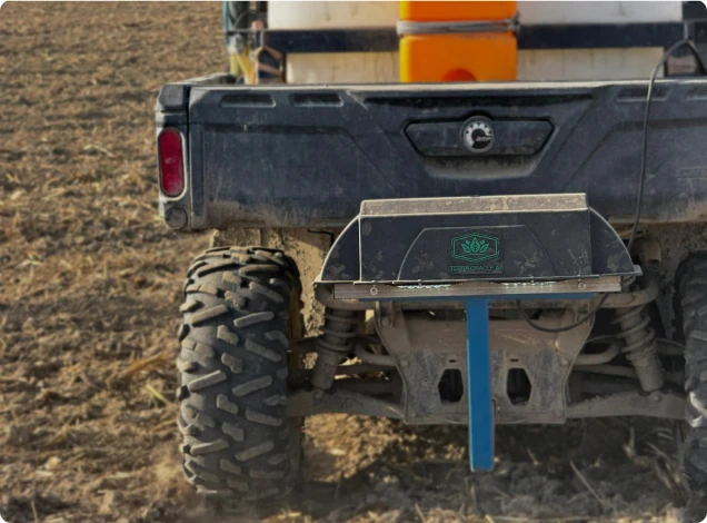
At Terra Oracle AI, calibration is treated as a core scientific discipline, not a post-processing step.
Data Is Measurement. Agronomy Is Interpretation.
A gamma sensor measures radiation intensity.
An EC sensor measures conductivity.
A satellite measures reflectance.
None of these measurements directly answer the question:
How much fertilizer should I apply here?
To move from signal to prescription, three layers are required:
- Calibration
- Statistical modeling
- Agronomic validation
Without these, maps risk being visually impressive but agronomically unreliable.
What Raw Gamma Data Actually Represents
Gamma-based soil scanning detects natural radiation from:
- Potassium-40
- Uranium-series elements
- Thorium-series elements
These isotopes correlate with mineral composition and clay content.
However, raw gamma counts do not directly equal:
- Available phosphorus
- Exchangeable potassium
- Plant-available nutrients
They reflect mineralogical structure.
To predict nutrient behavior, the system must learn the relationship between spectral signatures and laboratory-measured soil properties.
That is calibration.
The Calibration Process in Practice
A robust calibration workflow typically includes:
Zonal Identification
High-resolution gamma maps identify distinct soil zones.
Targeted Soil Sampling
Representative samples are collected from each zone.
Laboratory Analysis
Samples are analyzed for:
- pH
- Organic matter
- Exchangeable nutrients
- Texture
- CEC
- Additional macro- and micronutrients relevant to the calibration target
Model Training
Statistical or machine learning models link:
- Spectral features
- Spatial layers
- Lab-validated soil parameters
This transforms physical signals into agronomic predictors.
Field Example: Misleading Raw Signal Without Calibration
A 320-hectare sunflower operation adopted gamma scanning but initially relied only on relative intensity maps.
High-radiation zones were interpreted as high potassium areas and fertilizer was reduced accordingly.
After proper calibration sampling, results showed:
- Some high gamma areas were mineral-rich but potassium locked in non-available forms
- Certain medium-signal areas had lower exchangeable K than assumed
After recalibration and updated modeling:
- Potassium strategy was corrected
- Yield penalties in previously under-fertilized zones were reversed
- Fertilizer allocation stabilized
The initial error was not technological - it was interpretational.
Raw signal ≠ nutrient availability.
Field Example: pH Variability Hidden by Signal Alone
In a maize operation transitioning from grid sampling, gamma maps revealed strong textural contrasts.
Without calibration, management assumed texture zones aligned with pH zones.
Targeted lab sampling showed:
- Several clay-rich areas were acidic despite strong mineral signatures
- Sandy zones showed moderate pH stability
Variable-rate lime application based on calibrated data corrected acidity more accurately than texture assumptions alone.
Two seasons later:
- Nitrogen efficiency improved
- Yield variability decreased
Calibration prevented a costly oversimplification.
Why Calibration Strengthens Economic Decisions
Poor calibration increases risk in three ways:
Overconfidence in Relative Maps
Visually smooth maps can hide nutrient availability complexity.
Misaligned Fertilizer Allocation
Mineralogy does not always equal availability.
Reduced Trust From Agronomists
Professionals require validation before adopting recommendations.
When calibration is rigorous:
- Confidence increases
- Prescriptions become defensible
- Dealer credibility strengthens
- Economic outcomes stabilize
Calibration converts technology into infrastructure.
Model Drift and the Need for Periodic Recalibration
Soils evolve.
Crop rotation, fertilizer history, liming, and organic amendments alter chemical behavior over time.
Calibration models should be:
- Region-specific
- Crop-context aware
- Periodically updated
Best practice includes:
- Recalibration after major management changes
- Validation sampling during early deployment
- Continuous model performance monitoring
This prevents model drift and preserves accuracy.
Sensors, AI, and the Role of Agronomy
Within Terra Oracle AI, machine learning strengthens predictive modeling.
But AI does not eliminate the need for validation.
Strong systems integrate:
- High-resolution sensing
- Laboratory calibration
- Statistical robustness
- Agronomic logic
- Economic constraints
The objective is not to produce beautiful maps.
It is to produce reliable decisions.
The Structural Advantage of Calibrated Soil Intelligence
When calibration is properly implemented, several structural advantages emerge:
- Reduced interpolation error
- Improved variable-rate prescription accuracy
- Increased fertilizer efficiency
- Better economic modeling
- Higher dealer trust
The difference between raw data and calibrated intelligence is the difference between observing variability and managing it profitably.
Closing Perspective
Precision agriculture will continue to advance in sensing capability.
But sensing alone does not create value.
Value is created when measurements are:
- Validated
- Modeled
- Interpreted
- Integrated into operational decisions
Calibration is not a technical detail.
It is the foundation that transforms sensor outputs into agronomy.
Without calibration, data informs.
With calibration, data becomes decision-ready.
Scientific References
The Terra Oracle AI soil intelligence workflow follows established digital soil mapping principles: continuous proximal sensing, zonal calibration sampling, multivariate model training, and agronomic validation before prescription generation.
The principles discussed in this article are supported by peer-reviewed research in proximal soil sensing and digital soil mapping:
Viscarra Rossel, R.A., McBratney, A.B., & Minasny, B. (2010).
Proximal soil sensing. Springer.
- Foundational reference describing the theory and application of soil sensors and the necessity of calibration models.McBratney, A.B., Santos, M.L.M., & Minasny, B. (2003).
On digital soil mapping. Geoderma, 117(1–2), 3–52.
- Defines digital soil mapping frameworks, emphasizing predictive modeling from environmental covariates.IAEA (2003).
Guidelines for radioelement mapping using gamma ray spectrometry data. International Atomic Energy Agency.
- Technical reference on gamma spectrometry for geological and soil applications.Taylor, J.C., McBratney, A.B., & Whelan, B.M. (2007).
Establishing management classes for broadacre agricultural production. Agronomy Journal, 99(5), 1366–1376.
- Demonstrates economic value of zone-based management derived from spatial sensing.Viscarra Rossel, R.A. et al. (2011).
Visible, near infrared, mid infrared or combined diffuse reflectance spectroscopy for simultaneous assessment of various soil properties. Geoderma, 131–132, 59–75.
- Explains why multivariate calibration is essential for predicting soil properties from spectral data.Minasny, B., & McBratney, A.B. (2016).
Digital soil mapping: A brief history and some lessons. Geoderma, 264, 301–311.
- Reviews the transition from traditional sampling to model-based spatial soil prediction.Beamish, D. (2015).
Relationships between gamma-ray attenuation and soil properties. Journal of Environmental & Engineering Geophysics, 20(3), 217–229.
- Demonstrates relationships between gamma emissions and soil mineral composition.