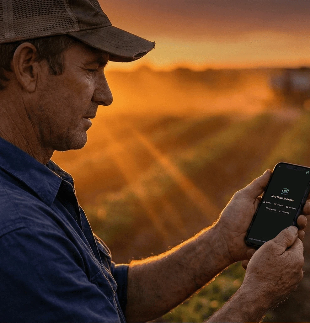
Meet Terra Oracle AI
Transforming
Agriculture through AI
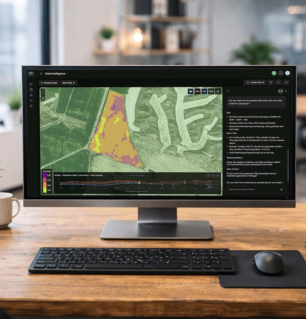
An AI Agronomic Advisor Built for Modern Farming
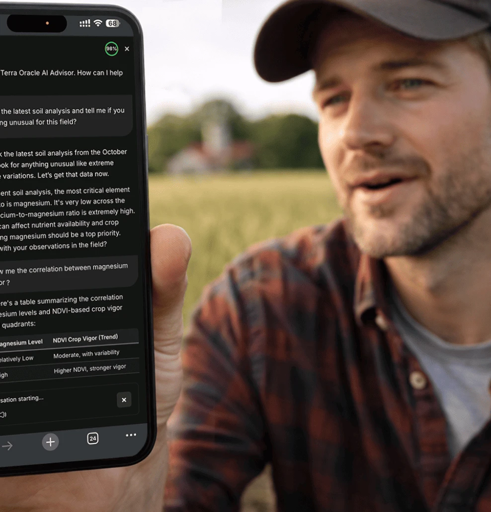
What the AI Agronomic Advisor Can Do for You
Turning Field Data into Better Agronomic Decisions
A simple, transparent process that turns complex agricultural data into clear decisions.
Tap a row to expand details and image.
How Terra Oracle AI Works Differently
Product Ecosystem
One Ecosystem. One workflow.
All insights are generated at the field level and adapt to
your location, conditions, and practices.


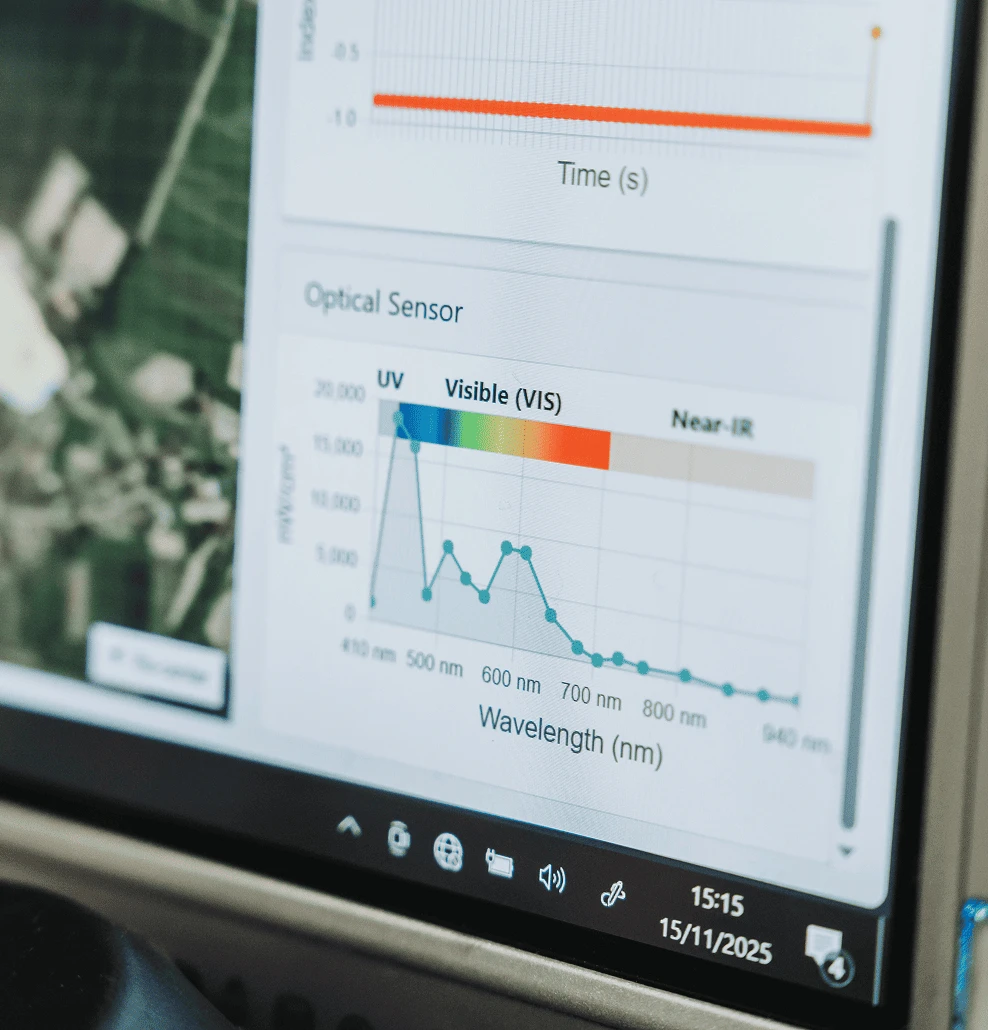
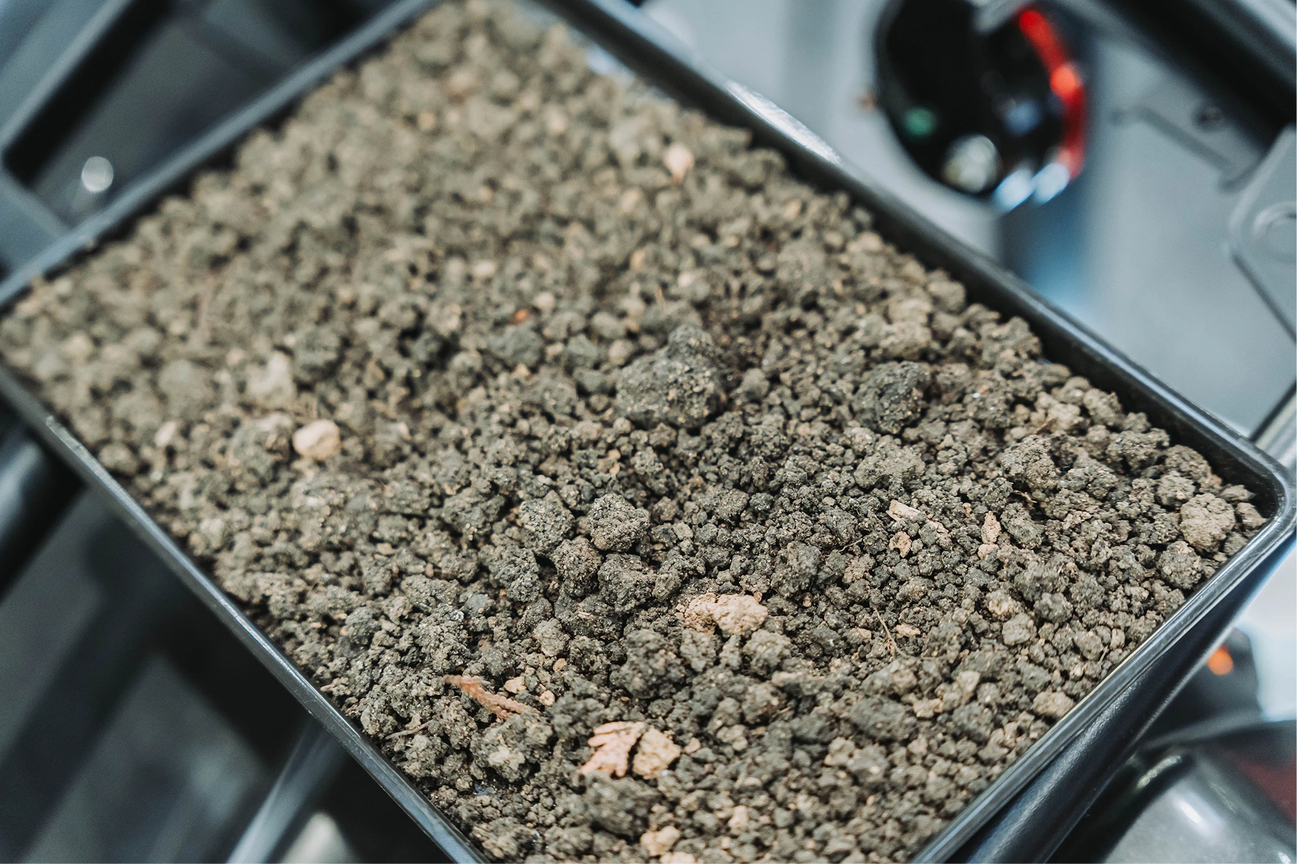
High-Resolution Soil Intelligence, Directly from the Field
Capture detailed, field-wide soil variability using a patent-pending dual-sensor scanner that combines:
- Gamma radiation data (K, Th, U) for soil structure and variability
- Optical sensing (NIR, VIS, UV) for surface composition and organic matter proxies
- Dense, high-resolution mapping across the entire field, not just point samples
- Reduced need for traditional soil sampling with scalable in-field deployment


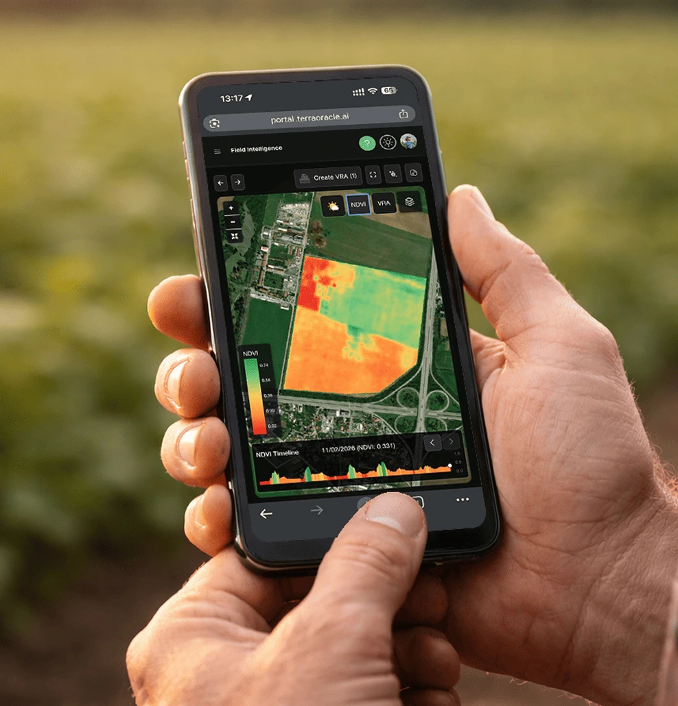
Your Field-Specific Agronomic Intelligence Platform
Access the Terra Oracle AI Portal, which brings together:
- Field-specific recommendations from the AI Agronomic Advisor
- Satellite imagery and vegetation indices (NDVI)
- Weather and historical field conditions
- Upload your own agronomic and operational data
Integrations
Powering Agriculture Together
We integrate with leading agri-tech, machinery, and data providers to deliver practical, field-ready AI solutions.
Pricing
Simple & Transparent Pricing
Start with full platform access for free, then scale by managed hectares and AI usage as your operation grows.
Free Tier
Full platform access for smaller operations
Soil scans and lab results across time
Satellite vegetation and NDVI history
Weather history and forecast data
Single- and multi-field VRA plans and prescription maps
Field boundaries, maps, and agronomic records
Multi-user, organization-level access
Field, farm, client, and organization structure
Platform Access
Full platform access priced by managed hectares
*Includes full platform functionality. AI Advisor usage is billed via credits.
Soil scans and lab results across time
Satellite vegetation and NDVI history
Weather history and forecast data
Single- and multi-field VRA plans and prescription maps
Field boundaries, maps, and agronomic records
Multi-user, organization-level access
Field, farm, client, and organization structure
Access to all available platform agronomic data
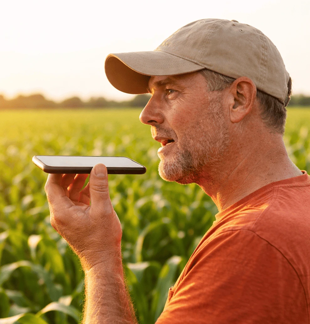
Multilingual Conversational Guidance - Text and Voice
Interpretation of soil, lab, NDVI, weather, VRA, connected operations data, and user-uploaded data
ROI and economics analysis
Credits are shared across the entire organization
Everything in Core
Field Monitoring and Alerting - Monitoring your fields 24/7
Everything in Pro
Higher monthly credit allowance for larger teams
Soil Scanning Services
High-Resolution Soil Scanning via Local Dealers
Terra Oracle AI soil scanning services are delivered through our authorized local dealer network, combining advanced hardware with on-the-ground agronomic support.
Includes:
Patent-pending dual gamma & optical soil scanning
High-resolution, in-field soil intelligence
Professional service delivery and local support
*Pricing and availability may vary by region and dealer
See The Platform In Action
Explore how the Terra Oracle AI platform turns field data into clear, actionable agronomic decisions - set up your field today to see results under your own conditions.
